
Flood Hazard Modelling Results
Past flood hazard modelling results for Hue are available.
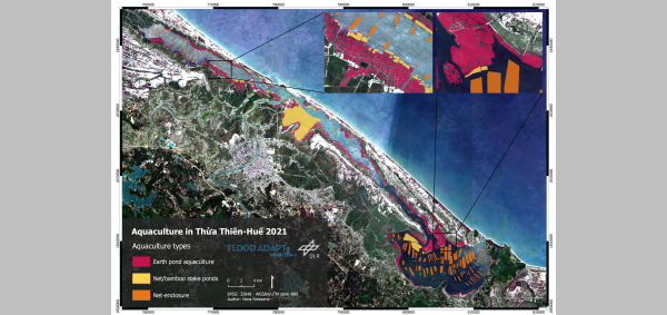
Aquaculture of the Tam Giang-Cau Hai lagoon
Aquaculture at the Tam Giang-Cau Hai lagoon was derived with radar remote sensing. The results show the intense farming of aquatic species in the Thua Thien Hue province.
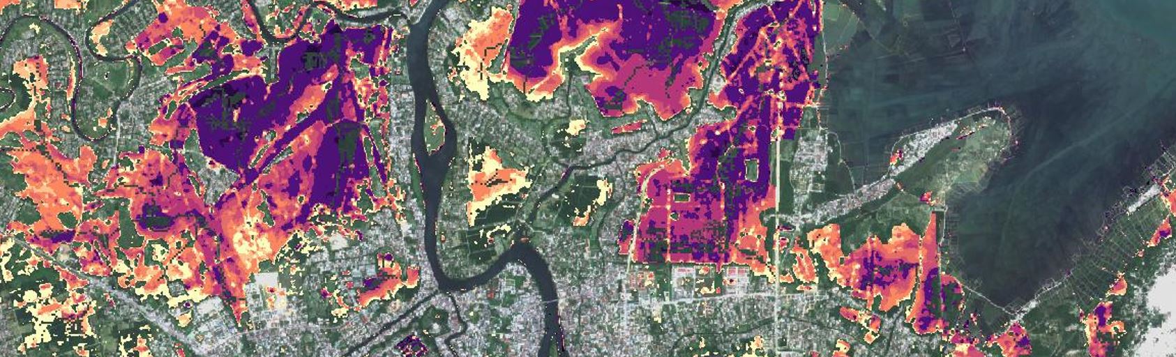
Flood Maps 2020
In 2020 Central Vietnam faced a series of six tropical storms and typhoons. Satellite technology was used to map the extent and duration of the flood areas
Precipitation and wind sensors installation
Low cost precipitation, temperature and wind sensors installation in the Perfume River catchment

35 years of coastline change in Thua Thien Hue
The Landsat mission archive of NASA allows to derive coastline and coastline changes over several decades. Coastline change hotspots, as well as stable section could be identified.
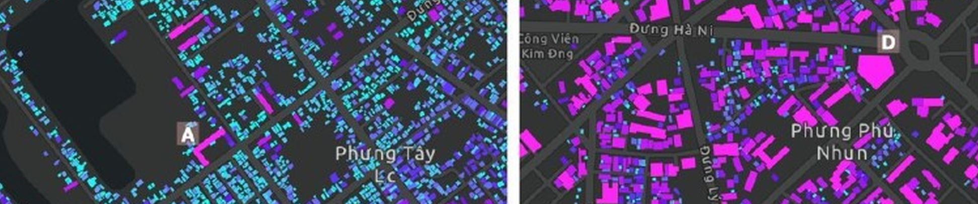
Building Types
A new Dataset of Asset Values for Building Types for TTH province
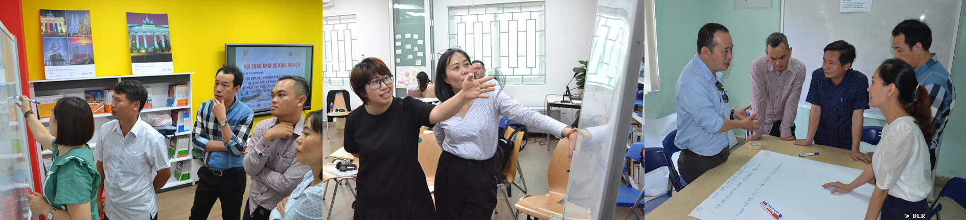
Regional Networking Forum 2023
1st Regional Networking Forum on Climate Change Adaptation, Flood and Disaster Risk Reduction.
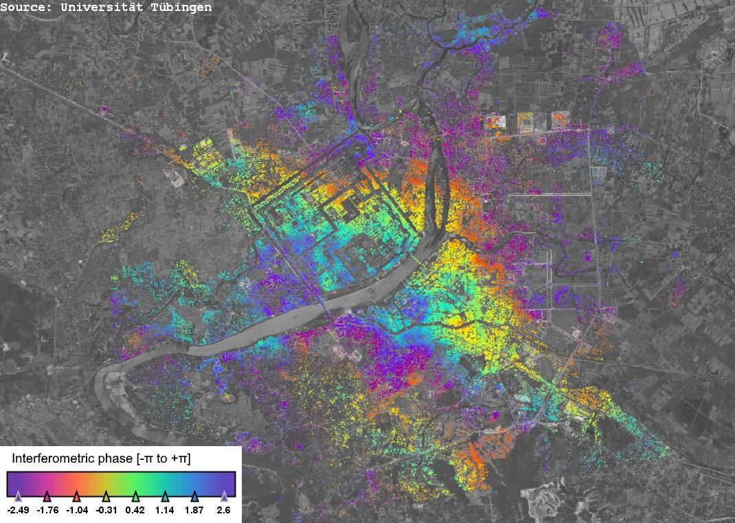
PAZ satellite radar interferogram of Hue
A radar interferogram shows the phase difference of two complex observations of the same area and can be used to derive elevation, as well as surface elevation changes.

European satellite data used for high-resolution land use mapping
The European COPERNICUS mission provides free satellite data for Earth observation mapping and monitoring.