FloodAdaptVN Approach
The main objective of FloodAdaptVN is to close critical research and knowledge gaps in fast-developing, flood-prone areas of central Vietnam. The project aims to support local authorities in designing effective Disaster Risk Reduction (DRR), risk transfer, and climate adaptation strategies. To achieve this, FloodAdaptVN assesses current flood risks, impacts, and future scenarios. It also explores the potential of risk transfer mechanisms and ecosystem-based and hybrid DRR and adaptation options as complementary solutions to conventional structural measures.
FloodAdaptVN follows a participatory, transdisciplinary co-development approach that brings together German and Vietnamese partners. Building on consultations in the Definition Phase, seven interlinked work packages were defined to co-develop, test, and apply solutions in collaboration with local stakeholders. The project maps current flood risks, exposure, vulnerabilities, and impacts, while investigating root causes. Using satellite and geospatial data, models simulate future flood scenarios (2030, 2050) to guide preventive planning.
Existing and planned flood risk reduction, risk transfer, and adaptation measures are identified at national, regional, catchment, and city levels, with a special focus on hybrid and ecosystem-based approaches. These are evaluated using jointly developed criteria, such as cost-effectiveness, social acceptance, and potential maladaptation risks. Integration into existing policy frameworks and planning cultures, together with capacity development and knowledge exchange, is a central aim.
Project Phases
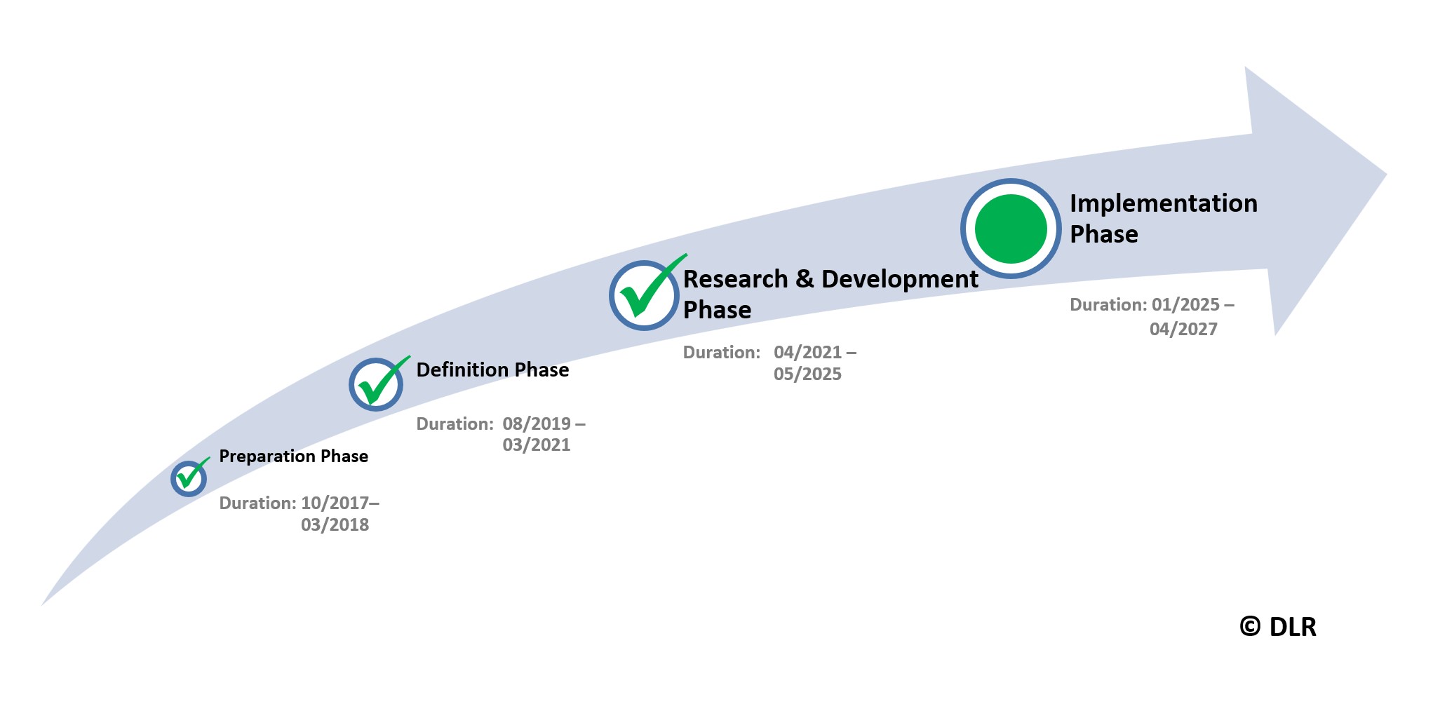
FloodAdaptVN began with a Preparation (2017–2018) and Definition Phase (2019–2021), refining objectives with stakeholders. The R&D Phase (2021–2025) focused on co-developing, testing, and applying solutions. Now, the Implementation Phase supports practical integration of project results into planning, risk governance, and decision-making processes in Huế. It further promotes scaling and transfer to other regions.

Implementation Phase Objectives
- Support the integration of information products, risk knowledge, and decision tools like FRAME into local planning and risk management.
- Strengthen capacity for risk-informed planning, including trainings on Earth observation, GIS tools, planning instruments, and monitoring methods.
- Accompany local stakeholders in applying risk reduction, risk transfer, and adaptation strategies in practice, ensuring uptake of project outcomes.
FloodAdaptVN Tools
Flood Risk Assessment
FloodAdaptVN is assessing past and current flood risk dynamics and hotspots and their associated impacts. This includes a joint investigation of the drivers of flood risk and how environmental conditions (land-use and land-cover, change analysis, topography, etc.), as well as socioeconomic and political factors, contribute to flood risk. Satellite imagery analysis, geospatial analysis and modeling are being used to map past and current flood events, and to evaluate the exposure and vulnerability of socio-ecological systems (SES) towards these floods as well as their impacts on different sectors (e.g. agriculture, economy, water quality, health).
Flood Modeling
In close collaboration with our Vietnamese scientific contributors and stakeholders, future flood risks are simulated combining future scenarios of flood hazards with future scenarios of exposure and vulnerability under environmental, climatic and societal change. Here we are benefiting from our preparatory work in the Definition Phase, for example by integrating data of installed climate stations or by applying simulation prototypes at larger regions and in greater detail.
Identification of Existing Measures
Existing flood risk reduction, risk transfer and adaptation solutions are being identified by FloodAdaptVN. This involves strategies and measures at national, regional, catchment, and city scale, and serve as a starting point for more detailed analyses at the neighborhood and household level. Thereby, a particular focus is placed on hybrid and ecosystem-based solutions as part of an overall risk reduction and adaptation strategy.
Evaluation of potentials for additional flood risk reduction, risk transfer and adaptation measures
FloodAdaptVN is also focusing on the integration of climate change concerns and flood risk reduction measures, strategies and plans into the existing legislative and policy framework. The intense exchange between German and Vietnamese scientific contributors is helping to identify both, existing barriers and opportunities for potential hybrid and ecosystem-based solutions. Capacity development and knowledge exchange between all contributing institutions accompany the process of understanding, analyzing current and simulating future flood risks. Planned activities include practical training on data handling and analysis, mainstreaming into development planning and international agendas as well as on-site workshops on regional best-practice examples of flood risk management.
Data management and exchange
A throughout framework of data management and exchange with the information system, as well as the utilization or remote processing centers to ensure the sustainable processing capabilities of all FloodAdapt contributors and stakeholders, completes our vision of the FloodAdaptVN research project. We are convinced that collaborative co-design, co-development and co-dissemination of our findings work best with a common database, which allows exchange, contribution, validation and feedback by all involved scientific institutions (following the FAIR principles).