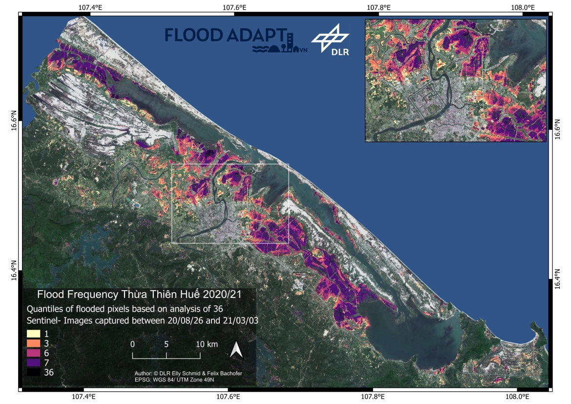
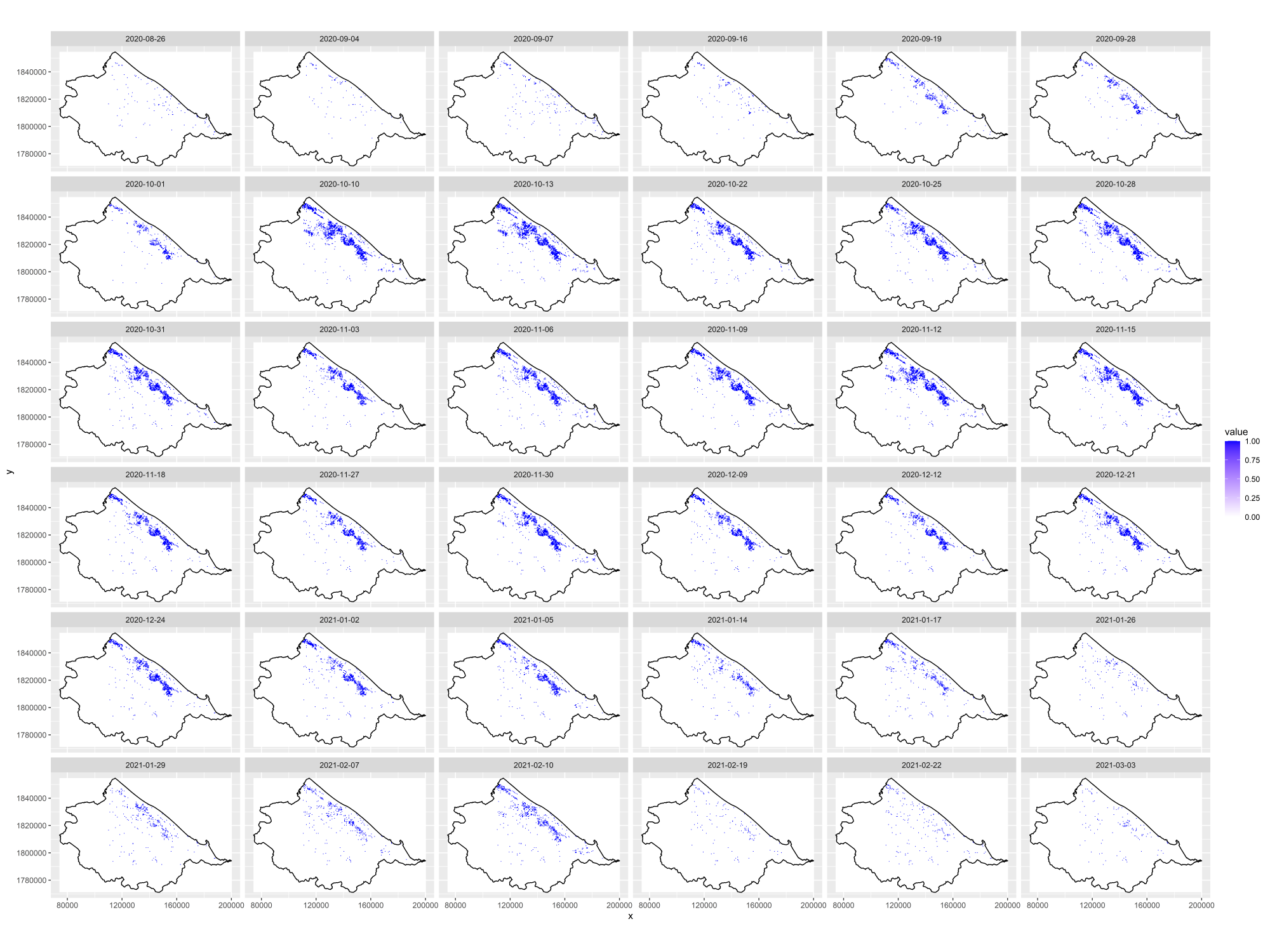
In 2020, Vietnam faced a series of six tropical storms and typhoons, resulting in extreme rainfall and widespread flooding, particularly in central regions. To analyze these events, all Sentinel-1 radar images from August 26, 2020, to March 21, 2021, were examined, totaling 36 observations. Flood masks were generated using OTSU thresholding to identify flooded areas.
The spatial distribution of flood frequencies was mapped, revealing that areas adjacent to lagoons and river streams experienced the highest frequency of flooding. The frequency of flooding decreased progressively with distance from these water bodies.

Figure 1: Flood Frequency of the investigation period (quantiles).

Figure 2: Floodmasks derived from 36 Sentinel1 Images throughout the investigation period.