The University of Tübingen investigates the potential of spaceborne interferometric radar for urban analyses and flood risk assessment. The image shows a differential interferogram of two images of the PAZ satellite launched in summer 2019. The two images were acquired on 31.10.2019 and 11.11.2019 over the city of Hue in StripMap mode at a spatial resolution of around 1 meter. Impacts of topography on the radar phase are clearly visible by the color coding. Each color cycle (a so-called “fringe”) represents surface variation towards the satellite at the scale of the wavelength of the sensor. This information can later be translated into absolute heights, for example for the analysis of runoff processes within the city. Furthermore, a series of 24 radar images will be analyzed to test their potential for the mapping of built-up areas and surface heights.
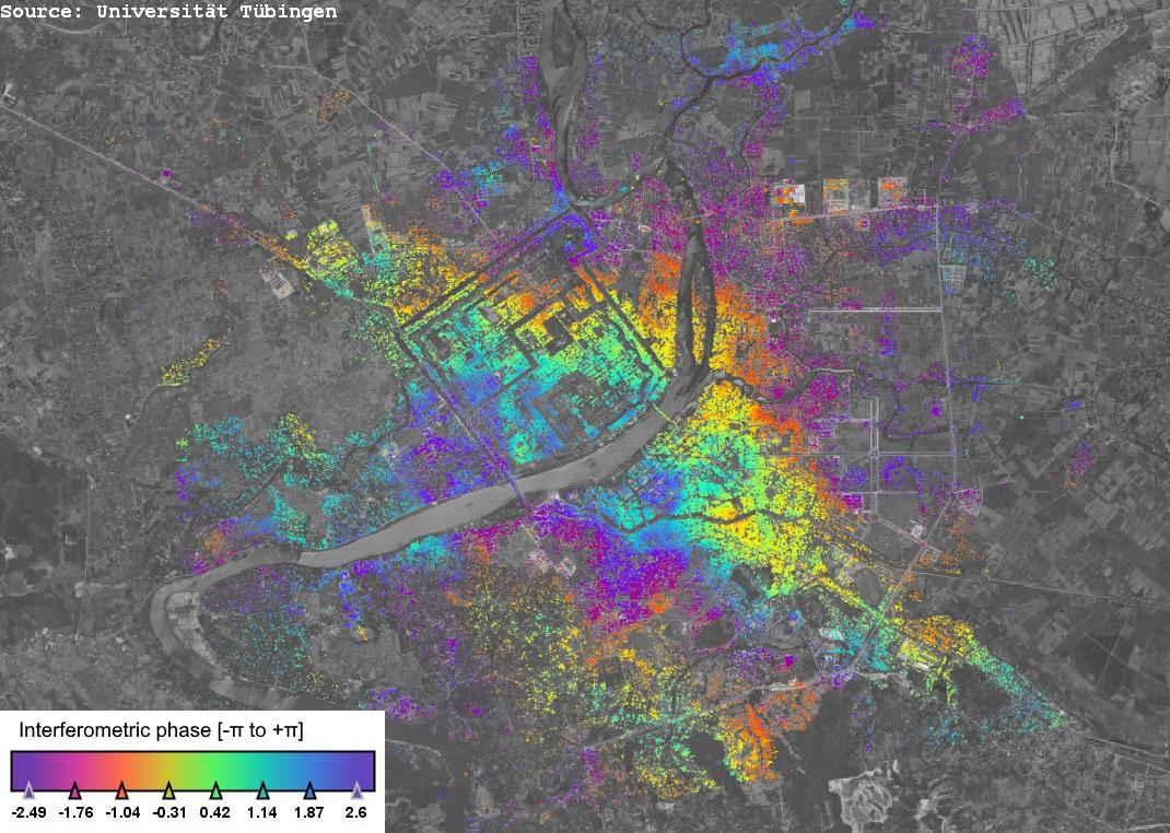
Figure: Fringe map of Hue resulting of a PAZ image pair of 31.10.2019 and 11.11.2019.