As part of the FloodAdaptVN project, a hydrological and hydraulic model was created to represent flood hazard. This is important for subsequent risk analysis, preparedness and adaptation to flood events in Huế.
The hydrological modelling includes the entire catchment areas of the Hương and Bồ rivers and the entire Tam Giang Lagoon (partly even an area in the neighbouring province of Quảng Trị). The HEC-HMS model calculates the discharges that serve as boundary conditions in the HEC-RAS (Hydrologic Engineering Centre) hydraulic model. The entire lowland area of Huế is modelled. The focus lies on modelling three historical flood events in 1999, 2020 and 2022.
In view of climate change and the associated sea level rise and increase in rainfall intensity during extreme events, several future scenarios were also calculated, taking into account the results of the urban growth model and climate change projections.
Results of future scenarios (RCP-SSP-based) are available upon request.
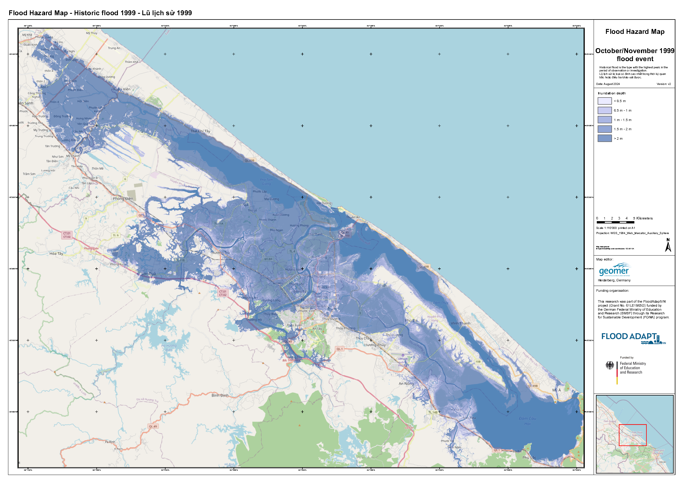
Figure 1: Flood hazard modelling result for the 1999 event (1:50,000; modelled with HEC-RAS).
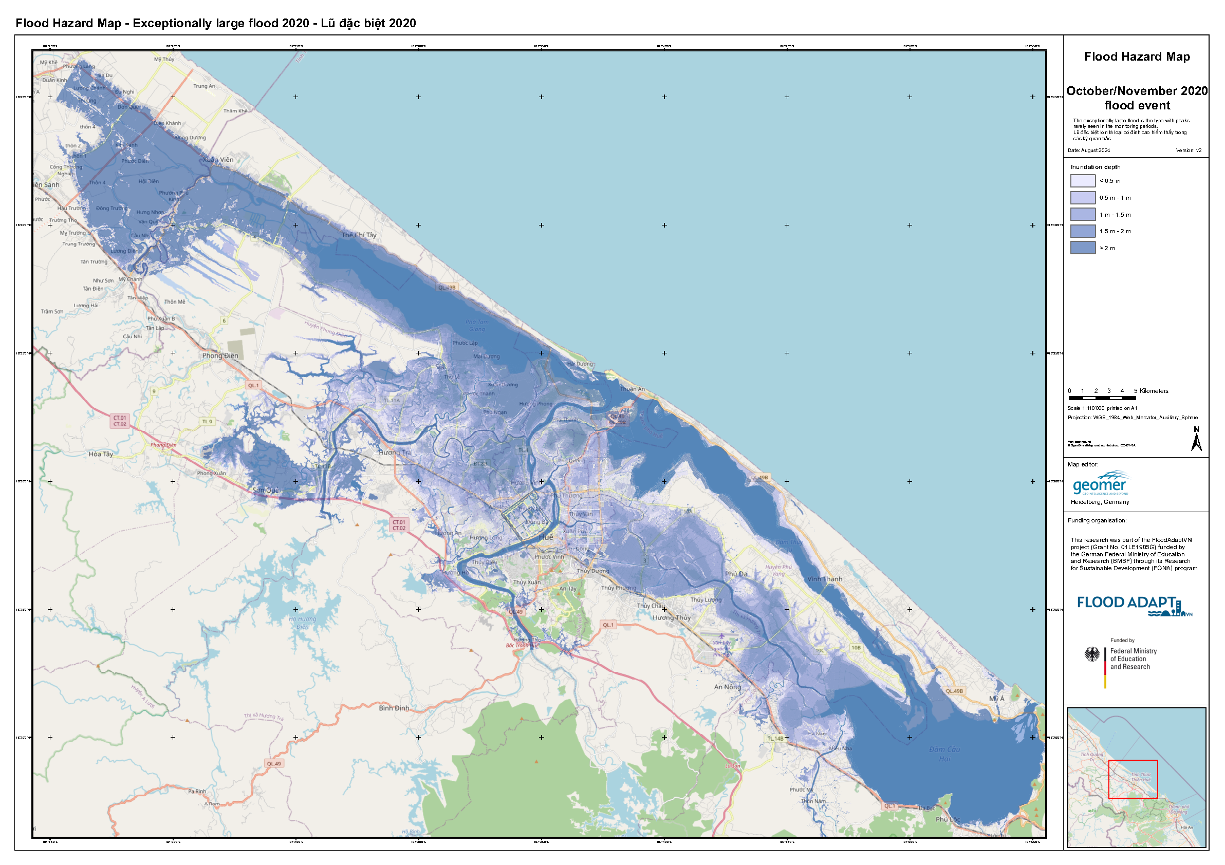
Figure 2: Flood hazard modelling result for the 2020 event (1:50,000; modelled with HEC-RAS).
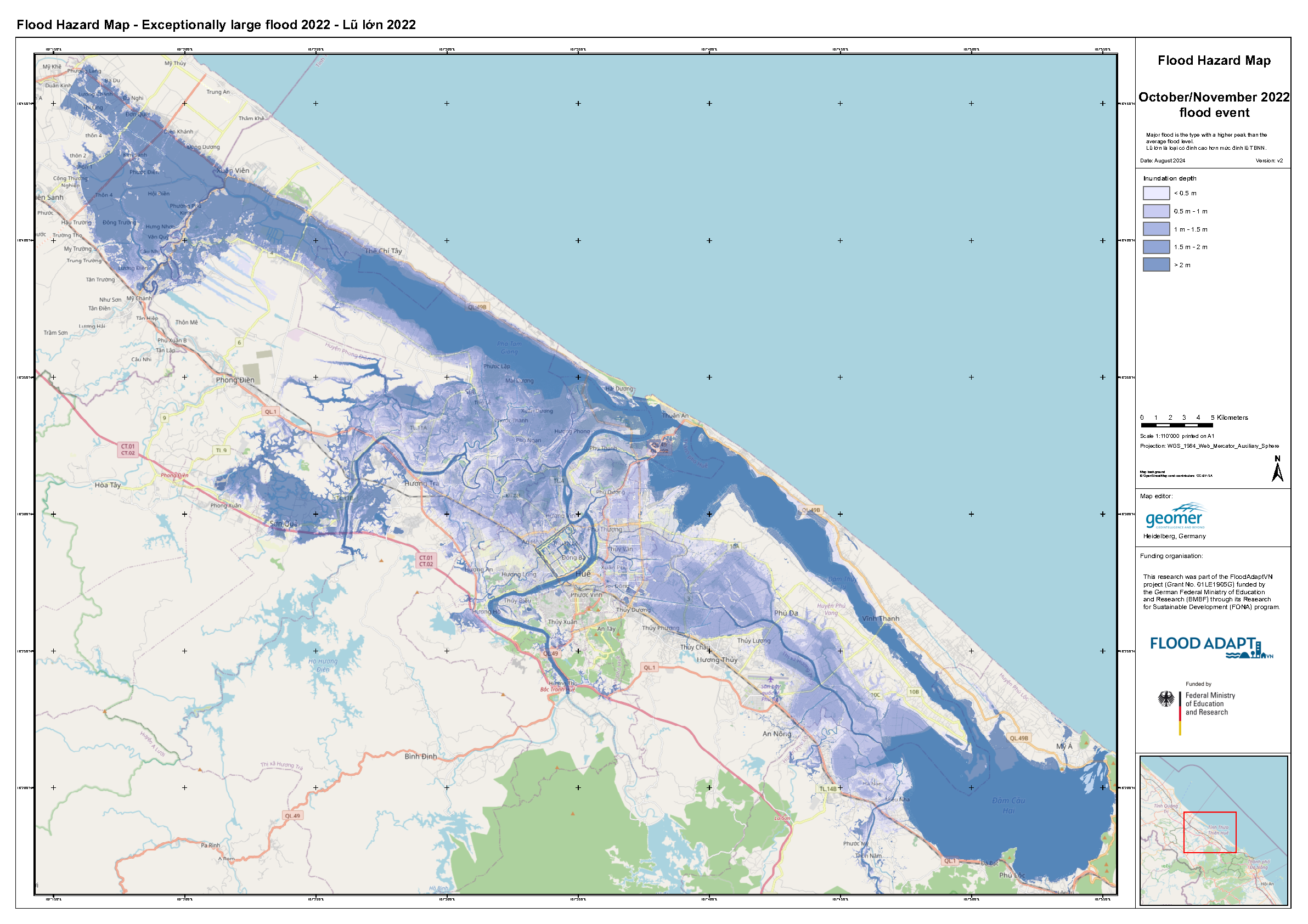
Figure 3: Flood hazard modelling result for the 2022 event (1:50,000; modelled with HEC-RAS).