Integrating Ecosystem-based Approaches into Flood Risk Management for Adaptive and Sustainable Urban Development in Central Viet Nam - from science to practice
FloodAdaptVN is an interdisciplinary research and development initiative that brings together Vietnamese and German partners to tackle the increasing challenges of flood risks in the city of Huế and its surroundings. Driven by climate change, rapid urbanization, and environmental degradation, these challenges demand integrated and risk-informed approaches for sustainable urban and regional development.
Project Objectives
- Assess current and future flood risks under changing climatic and socio-economic scenarios, focusing on hazard, exposure, and vulnerability dynamics.
- Identify and prioritize innovative adaptation and risk-reduction measures, including ecosystem-based and nature-based solutions.
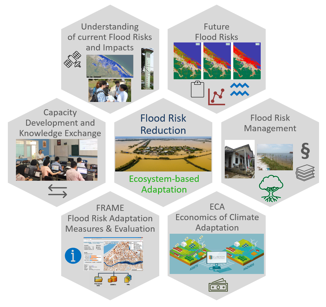
- Develop and operationalize a modular, WebGIS-based decision-support system (FRAME) to support risk-informed planning and decision-making processes.
- Enhance capacities of local stakeholders and decision-makers through training, co-design, and participatory visioning workshops.
Implementation Phase (2025-2027) Objectives
- Building on the insights and tools of the R&D phase, the Implementation Phase aims to:
- Integrate project results and FRAME into existing governance and planning frameworks at the city, provincial, and national levels.
- Strengthen cross-sectoral and multi-level collaboration to ensure coordinated and sustainable flood risk management.
- Support stakeholders in using FRAME and other information products to identify, plan, and monitor adaptation measures effectively.
- Foster capacity development through tailored trainings on advanced monitoring, Earth observation, scenario planning, and local knowledge integration.
- Promote the transfer and scaling of successful strategies and tools to other flood-prone regions in Vietnam and beyond.
Key Achievements of the R&D Phase (2021-2025)
- High-resolution flood risk assessments developed for multiple future scenarios, highlighting current and potential future hotspots for flooding in Huế.
- Quantification of expected impacts (economic, social, and environmental) and prioritization of adaptation measures using advanced modeling techniques.
- Establishment of FRAME, a cutting-edge WebGIS platform enabling dynamic scenario analysis, cost-benefit assessments, and integration of adaptation measures.
- Deep stakeholder engagement through workshops, trainings, and participatory processes to co-develop locally relevant and implementable solutions.
- Scientific foundations for transitioning from hazard-based approaches to risk-informed and ecosystem-based planning.
Integrative, Transdisciplinary and Collaborative Research Design
Complex problem profiles require resourceful capacities and knowledge to engage them. The impetus of FloodAdaptVN is co-design and co-develop innovative ideas with our multiple internal and external stakeholders. In order to create actionable results that lead to sustainable solutions and the implementation of measures, a co-design approach with all relevant stakeholders from the initial project idea of FloodAdaptVN to the final implementation of the outcomes is our philosophy. The inter- and trans-disciplinary research design of FloodAdaptVN brings together methods and expertise in spatial planning, legal processes, policy making, satellite remote sensing, spatial data processing, flood modeling, climate change, geography, risk and hazard assessment, and more…
Open and Transparent Research
FloodAdapt VN commits to open and transparent research practices that follow the FAIR principles in order to make data and research results Findable, Accessible, Inter-operable and Reusable. Contact us for more details.
Funding
The FloodAdaptVN project, funded by the German Federal Ministry of Research, Technology and Space (BMFTR) under the Sustainable Development of Urban Regions (SURE) funding initiative, is currently in the Implementation phase of 24 months (06/2025 – 05/2027).
Join Us in Shaping a Flood-Resilient Future
The FloodAdaptVN project demonstrates how science, policy, and practice can work together to build a safer and more sustainable future for communities in Huế and beyond. Stay engaged as we move into the Implementation Phase and turn insights into action.
Contact
For further information, please contact:
Dr. Felix Bachofer (Project Lead)
German Aerospace Center (DLR),
Earth Observation Center (EOC), German Remote Sensing Data Center (DFD)
82234 Wessling (Oberpfaffenhofen)
Germany
Email: felix.bachofer [at] dlr.de