This page is not yet translated into the language "vi", so the english page is displayed.
Six measurement stations were prepared for installation by the Hue University, DLR, geomer and the University of Tuebingen. The collected data is shared with the local administrative bodies and universities. Within the FloodAdaptVN project, the wind and precipitation measurements will be used to calibrate the flood modeling together with data provided by the local authorities. Unfortunately, we lost some stations during the storms in the autumn 2020 flooding season.
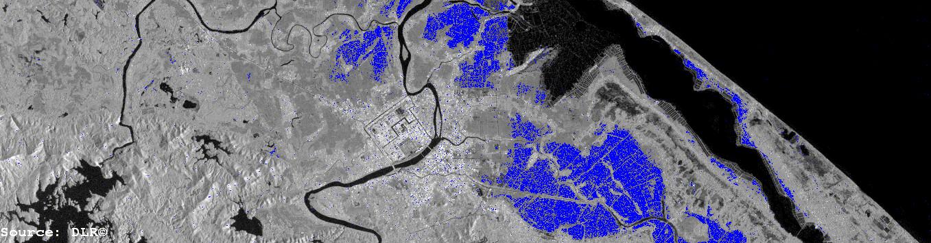
Figure: Preliminary flood map derived from Sentinel-1 (Nov. 2017)